BORDERING SYMBIOSIS | informal armatures | urban design
Delving into the development of urban strategies that address and define preemptive steps towards the growing emergence of unplanned urban growth, the project aims to provide urban solutions that cater to the needs of self-made settlements whilst incorporating the positive aspects of informality.
Following David Gouverneur’s Informal Armatures Approach — a preemptive urban approach to the sustainable growth of informal settlements — and focusing on Guadalajara as a city of study, the project explores how natural, urban and architectural interventions can be integrated into solutions that foster gradual, controlled development.
The workshop unfolded in three stages: a strategic site study — research and mapping of existing conditions and definition of general strategies; an urban proposal — exploring the proposed general strategies and urban interventions at a bigger scale; and sector interventions — the development of design and urban interventions adapted to specific sector conditions.
COLONIAS DE LA BARRANCA
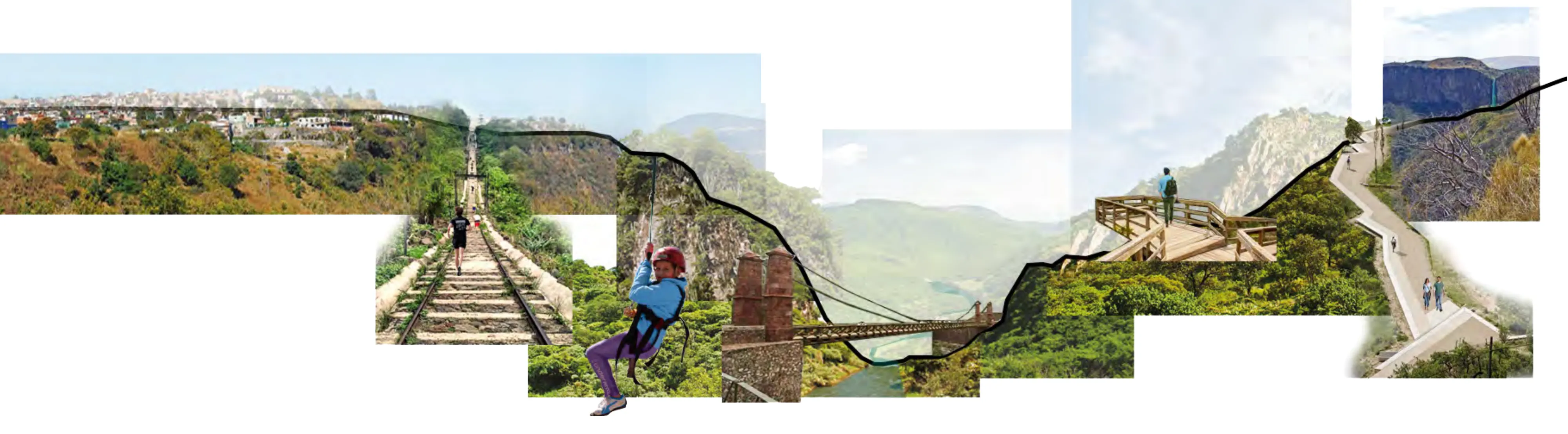
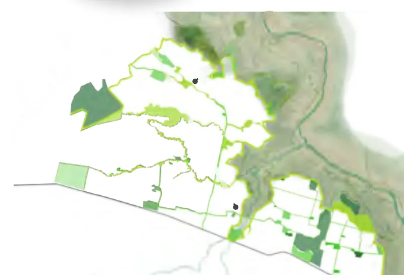
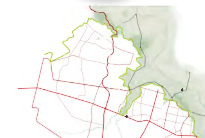
Located at the northern periphery of Guadalajara, bordering the 600-meter-deep Huentitán’s Canyon natural reserve, the case study encompasses an extensive area of underdeveloped and unmanaged self-made developments.
Bordering the natural landscape of La Barranca de Huentitán, the northern periphery of Guadalajara was initially destined for agricultural purposes. Over time, with the growth of the city, the small townships that occupied the area expanded into informal, self-made developments that lack basic infrastructure and are slowly growing into the natural limits.
Based on this clear dissociation between the expansion of the urban system and the natural environment of the canyon, the proposal seeks to blur this limit, creating a system of multi-scale relations centered around the definition of green open spaces and their integration with the different urban dynamics of the area.
CONNECTIVITY | INTEGRATION | TRANSITION
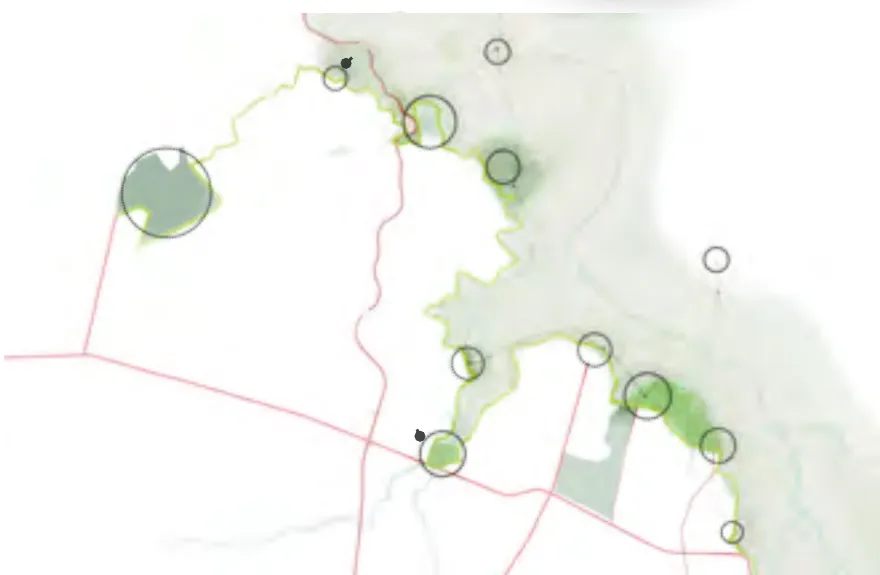
The project pursues three objectives: connectivity between green areas and public spaces; integration of the formal and self-constructed urban dynamics; and transition within city scales and the bordering natural reserve.
These objectives translate into four general strategies — the proposed informal armatures for the case study — whose general proposal, plan and schemes were developed by the whole team.
MASTER PLAN
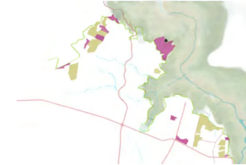
Serving as a testing ground for the general strategies, the definition of the intervention area enabled a more thorough exploration of the proposed systems within the consolidated, non-consolidated and potential areas of the site.
In order to address the specific characteristics of these urban conditions, a set of strategies was developed as a shared framework for site interventions: defining the protective border and main arteries, establishing green corridors and stewards, and consolidating superblocks.
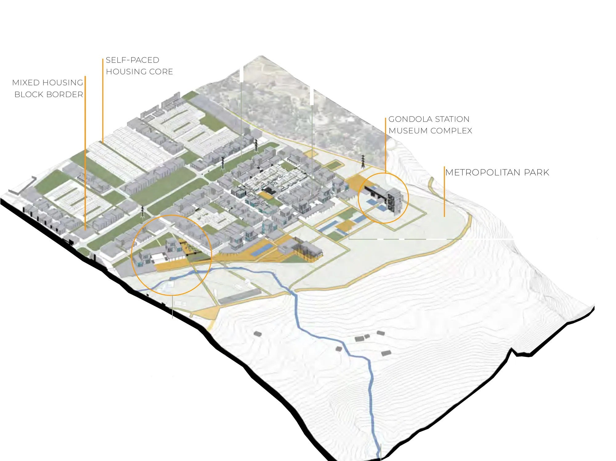
To explore these intervention strategies in greater detail, two sectors were identified and selected as testing scenarios, based on the development stages and the shared characteristics they possess: Zapopan’s urban regeneration — progressive interventions within existing communities — and Huentitán’s expansion — the assisted emergence of new, self-made developments.
ZAPOPAN’S TRANSFORMATION
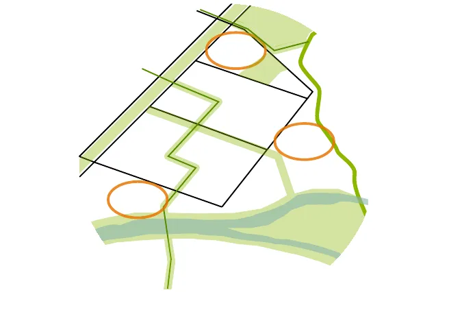
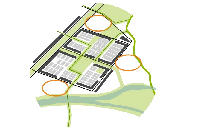
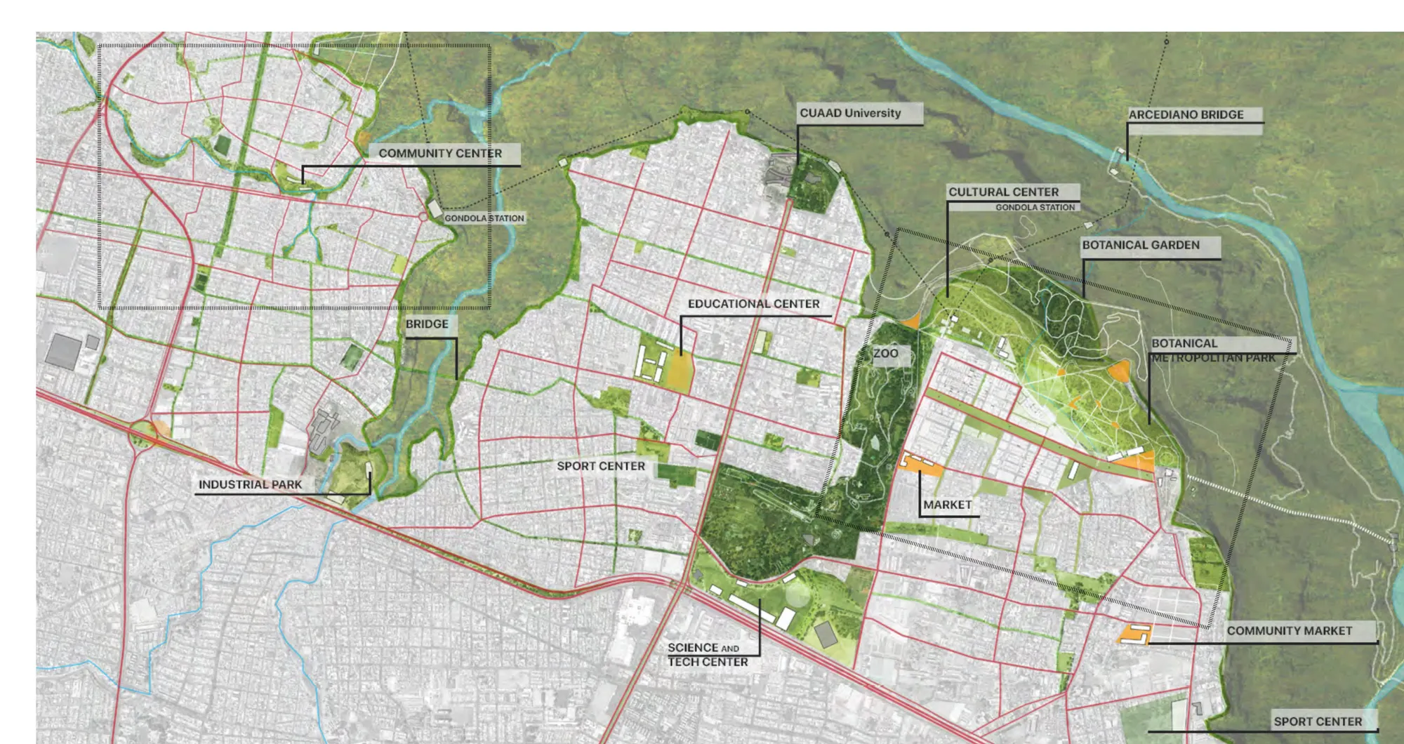
The specific site proposal makes use of the existing layout, conditions and potentials of the site, guiding the process of transformation by:
01 — Defining strategic nodes that integrate natural resources and existing infrastructure, protecting the border from expansion and determining a mobility hierarchy within the existing grid.
02 — Establishing primary corridors as attractors of public activities, consolidating the existing layout into superblocks by promoting mixed-use and typological variety in its borders.
03 — Fostering neighborship within the superblocks, by redefining secondary paths as pedestrian corridors or linear parks; incorporating within the existing layout facilities and amenities as stewards of community spaces.
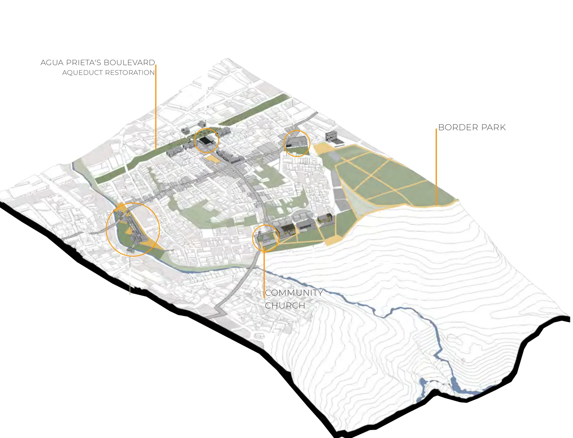
Four nodes anchor the proposal along the border: healthcare and public infrastructure; a local market and the aqueduct’s restoration; a cultural border complex; and the river’s community centre.
PHASED INTERVENTIONS
The two testing scenarios — Zapopan’s transformation plan and Huentitán’s new development — share a common phasing: intervention of existing site elements; border definition and primary stewards; main connections and superblock definition; and progressive growth and sector consolidation.