LINKING CITYSCAPES | public infrastructure | learning centers

location:
La Charneca, Caracas, Venezuela
programme:
Public infrastructure | Learning centers
Academic project | Simón Bolívar University
Design Workshop X | Individual project
April – July 2021 · 14th trimester (Year V)
supervisors:
Arch. José G. Frontado | Eng. Nicolás Labropoulus | Arch. Claudia Dürre (invited professor)
Aerial render of the proposal by Angelica De Bernardo: the terracotta lattice bridge crosses the highway from the city center into La Charneca's hillside, meeting the tower of the new community center, while circular callouts highlight the northern civic plaza, the bridge as a public space, the rooftop terrace and the southern node plaza.

In a segmented city like Caracas, the distinction between formal and informal is very clear, not only morphologically and socially, but also in terms of accessibility, service provision and imbalances in basic infrastructure and public amenities.

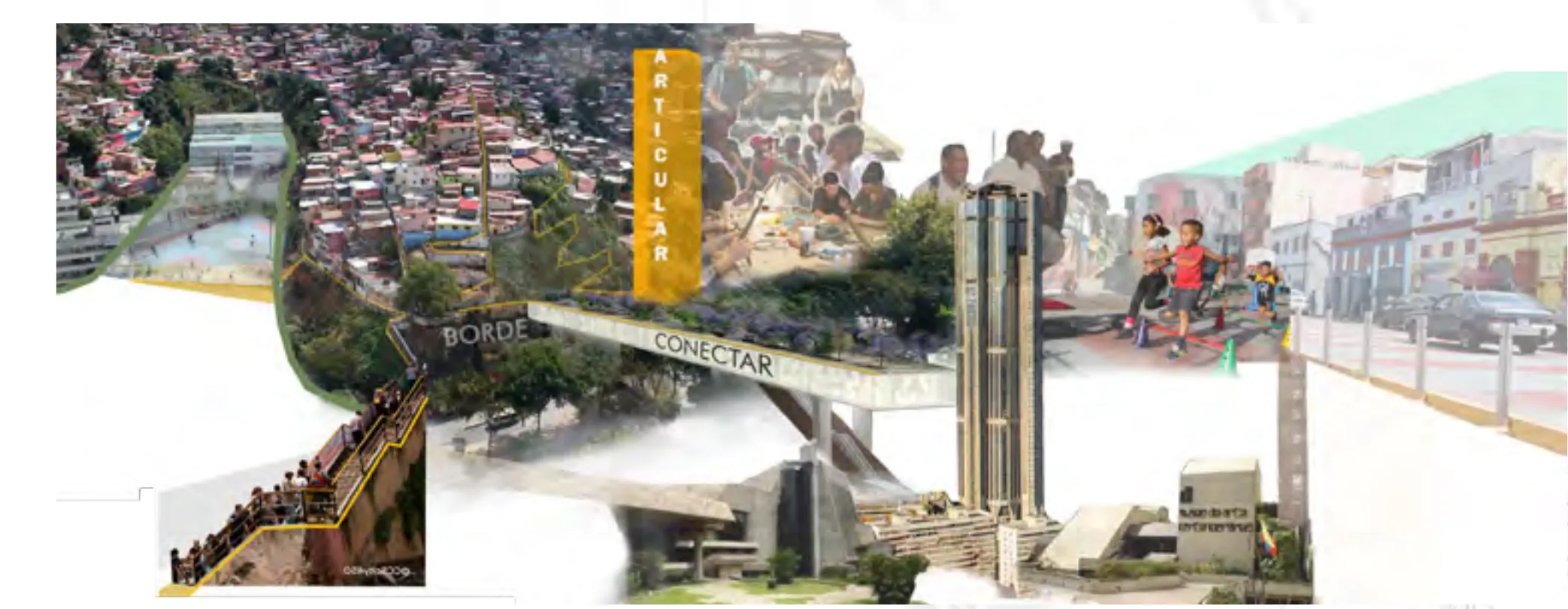
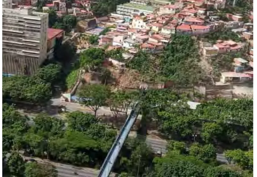
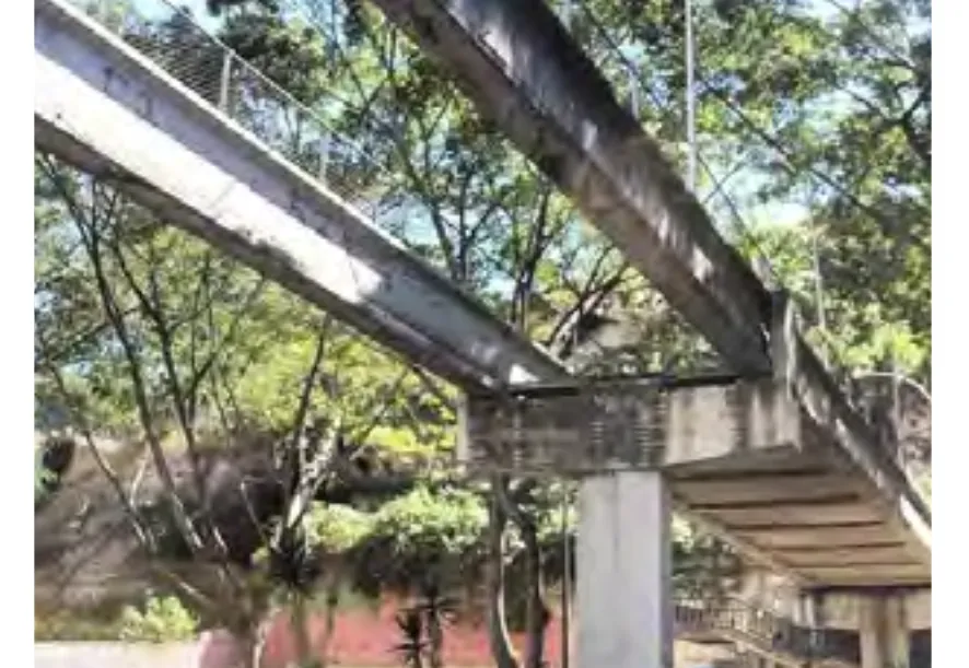
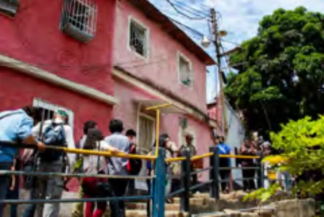
In localities like La Charneca, this division is stark. Despite its proximity to the urban center of Caracas, the city’s own evolution has reinforced the natural limit of El Guaire River with highways that run along its path, further intensifying the north-south division between the city center and the community. The self-produced nature of the settlement has also resulted in a lack of public amenities and poor connectivity, and its progressive expansion into the steep, risk-prone slopes of the area has led to landslides and terrain collapses over the years.

Aiming to improve urban mobility, mitigate risks and create opportunities for local residents, the project presents itself as a way to resolve the urban encounter between the formal and informal, proposing a community learning center that expands on existing local initiatives and acts as an urban connector, linking the contrasting conditions of the site’s context whilst providing new spaces for the community.

Concept collage layering photographs of La Charneca's hillside settlement, El Guaire river, pedestrian walkways and street life of Caracas with sketches of the crossing, annotated with the words articular, borde and conectar.
CONCEPT COLLAGE author: Angelica De Bernardo

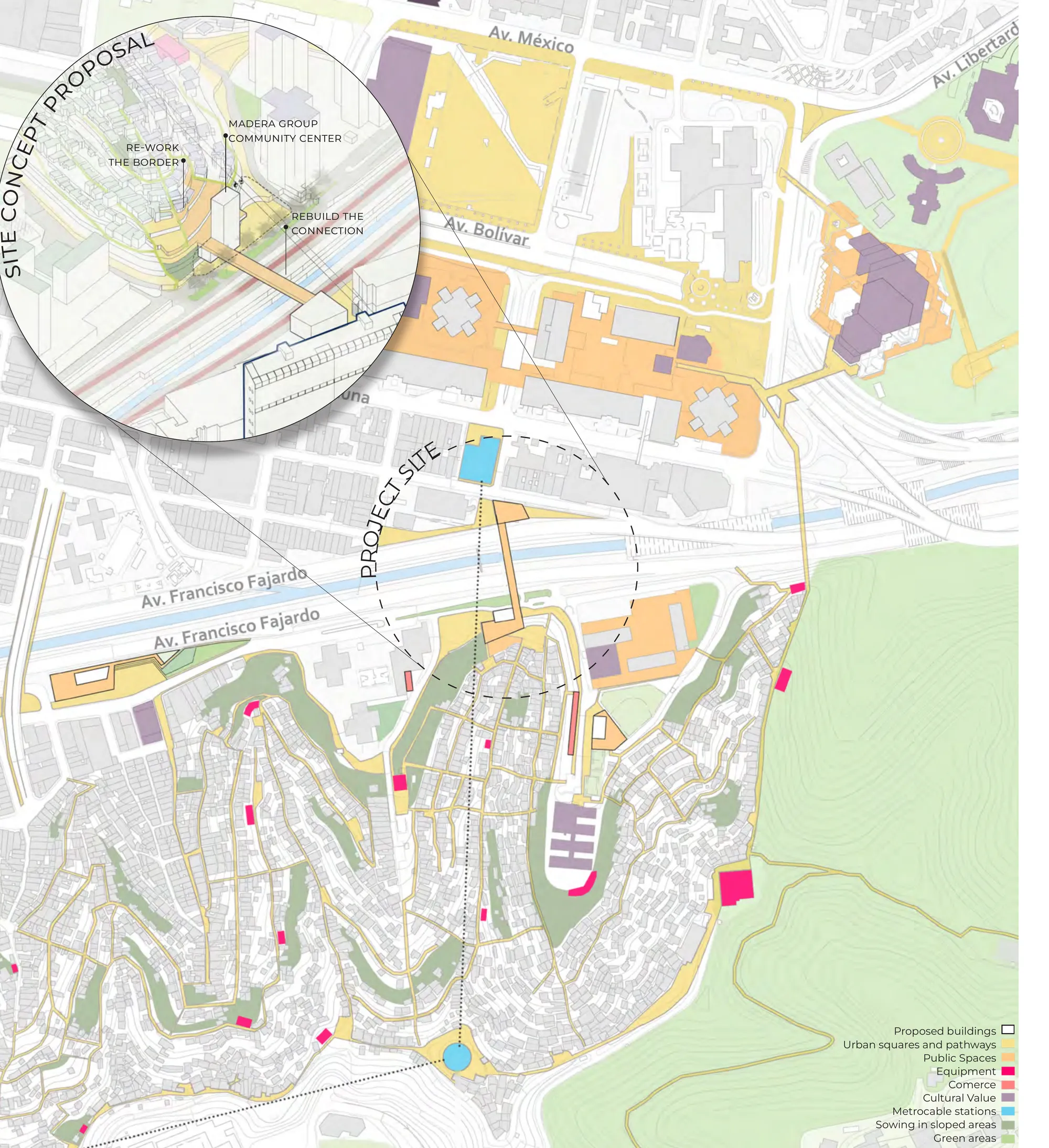
SITE CONDITIONS | ANALYSIS + PROPOSED STRATEGIES

Based on the site analysis and the developed urban strategies’ plan, the project site is defined as an articulation point between the main entrances to the community. Additionally, seeking to improve the connections across the river’s limit, the proposal integrates the restitution of the collapsed pedestrian bridge as part of the project objectives.

Aerial photograph of the site: La Charneca's dense hillside houses descending towards the green river edge, with the existing pedestrian bridge crossing among the trees.
SITE FROM ABOVE taken in site visit
Photograph of the collapsed pedestrian bridge: fallen steel walkway beams resting against a concrete pier among the trees.
PEDESTRIAN BRIDGE COLLAPSE (2021) from: vtv.gob.ve
Photograph of a pedestrian path in La Charneca: people walking along a railed walkway beside a red house.
PEDESTRIAN PATHS from: ccscity.com
Photograph of the Madera Group foundation: musicians playing guitars and traditional instruments together in a community room.
MADERA GROUP FOUNDATION community initiatives — from: cronicassinfiltro.wordpress.com
Pastel-toned general urban strategies plan: the city center grid north of the Francisco Fajardo highway and La Charneca's winding hillside fabric to the south, marked with proposed buildings, urban squares and pathways, public spaces, equipment, commerce, metrocable stations and green areas; a circular zoom inset details the site concept proposal — re-work the border, rebuild the connection, Madera Group community center.
GENERAL URBAN STRATEGIES urban proposal — made in collaboration with Rosa Moreno, Fernando Peraza and María Nieto

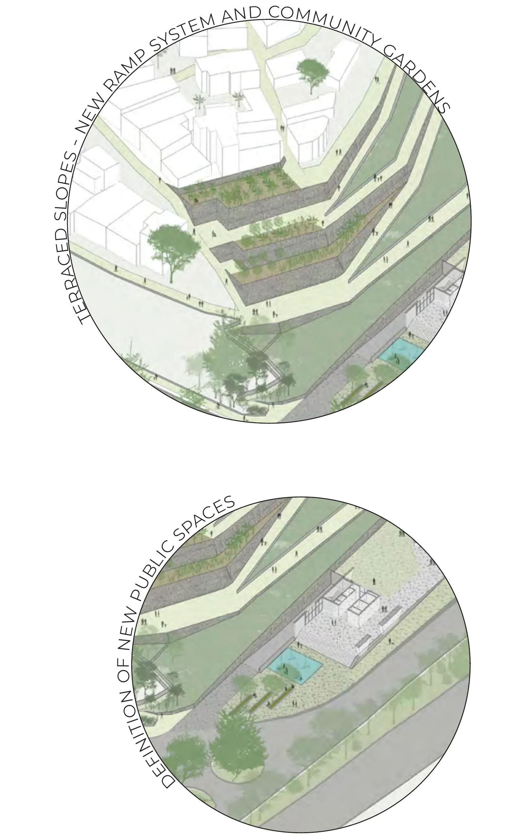
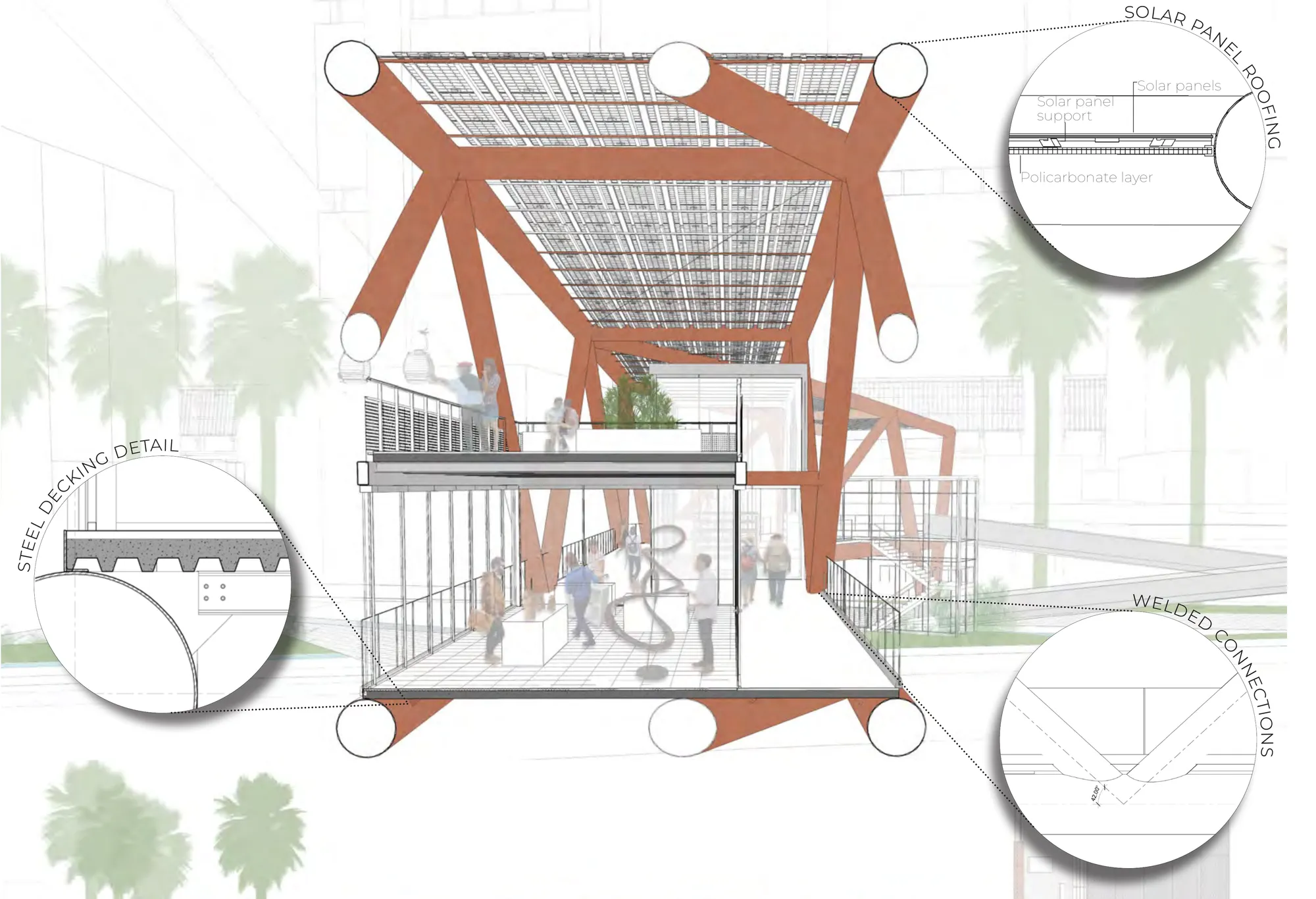
DESIGN ELEMENTS | PROJECT OBJECTIVES

The design pursues three objectives: 1. improve existing connections and mobility, by reinforcing pedestrian connectivity and providing new public spaces for the community; 2. create a site-responsive community center, by integrating existing local initiatives, providing new skill-learning opportunities, and defining commercial spaces for local entrepreneurship; and 3. mitigate the existing landslide risk, by creating terraced community gardens that integrate multilevel productive areas into the community.

Two circular vignettes of the proposal: terraced slopes with the new ramp system and community gardens stepping between the existing houses, and the definition of new public spaces around a pool plaza along the lower road.
TERRACED SLOPES AND NEW PUBLIC SPACES new ramp system and community gardens · definition of new public spaces
Two interlocking circular diagrams: an exploded axonometric of the Madera Group Foundation community skill center, its pastel floor plates labeled classrooms, carpentry area, luthier workshop, musical studies and terrace; and below, the bridge structure bridging the gap — reinforcing north-south connections with artisan exhibits, commerces and the pedestrian crossing.
MADERA GROUP FOUNDATION — COMMUNITY SKILL CENTER exploded axonometric · bridging the gap — reinforcing north-south connections

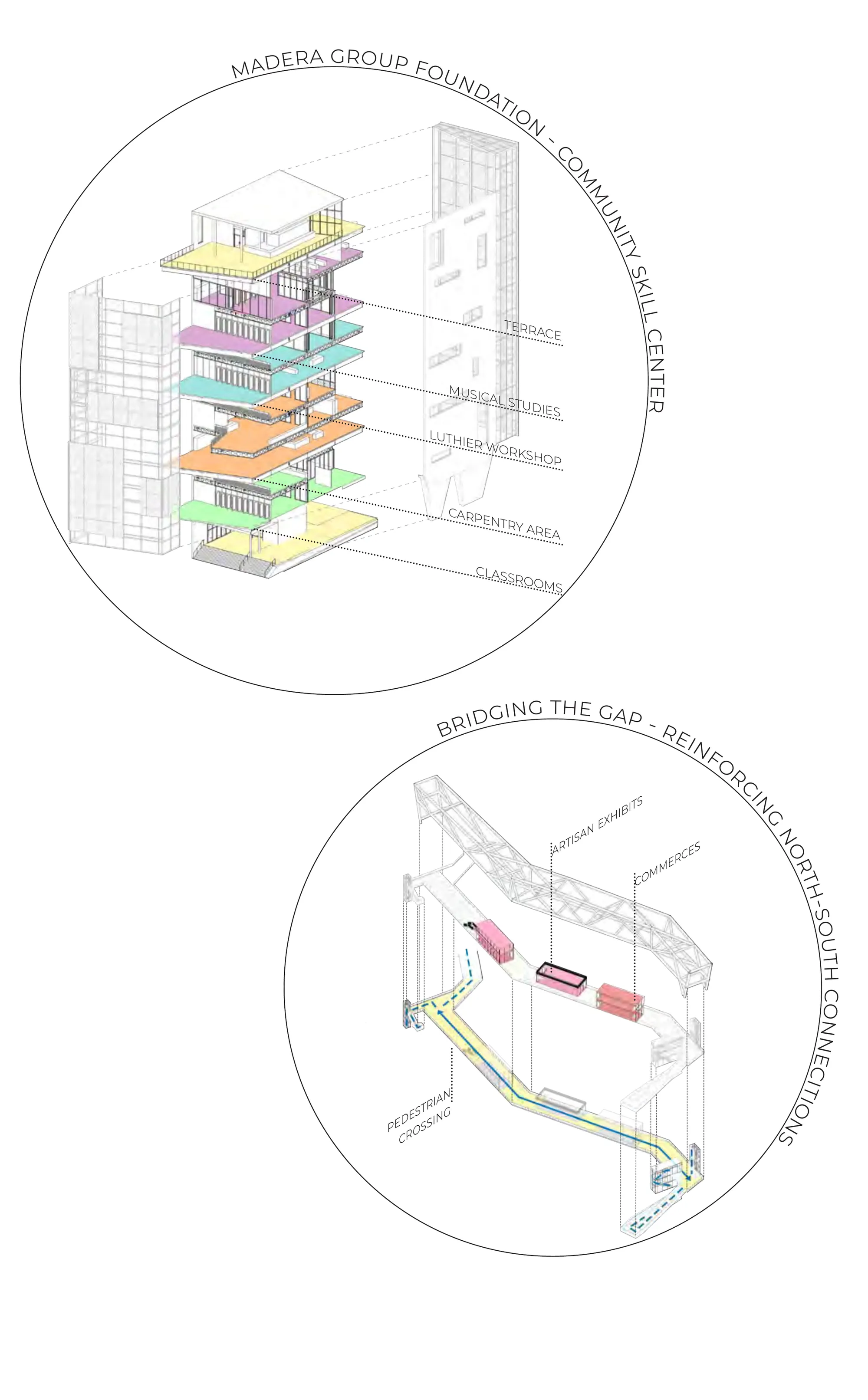
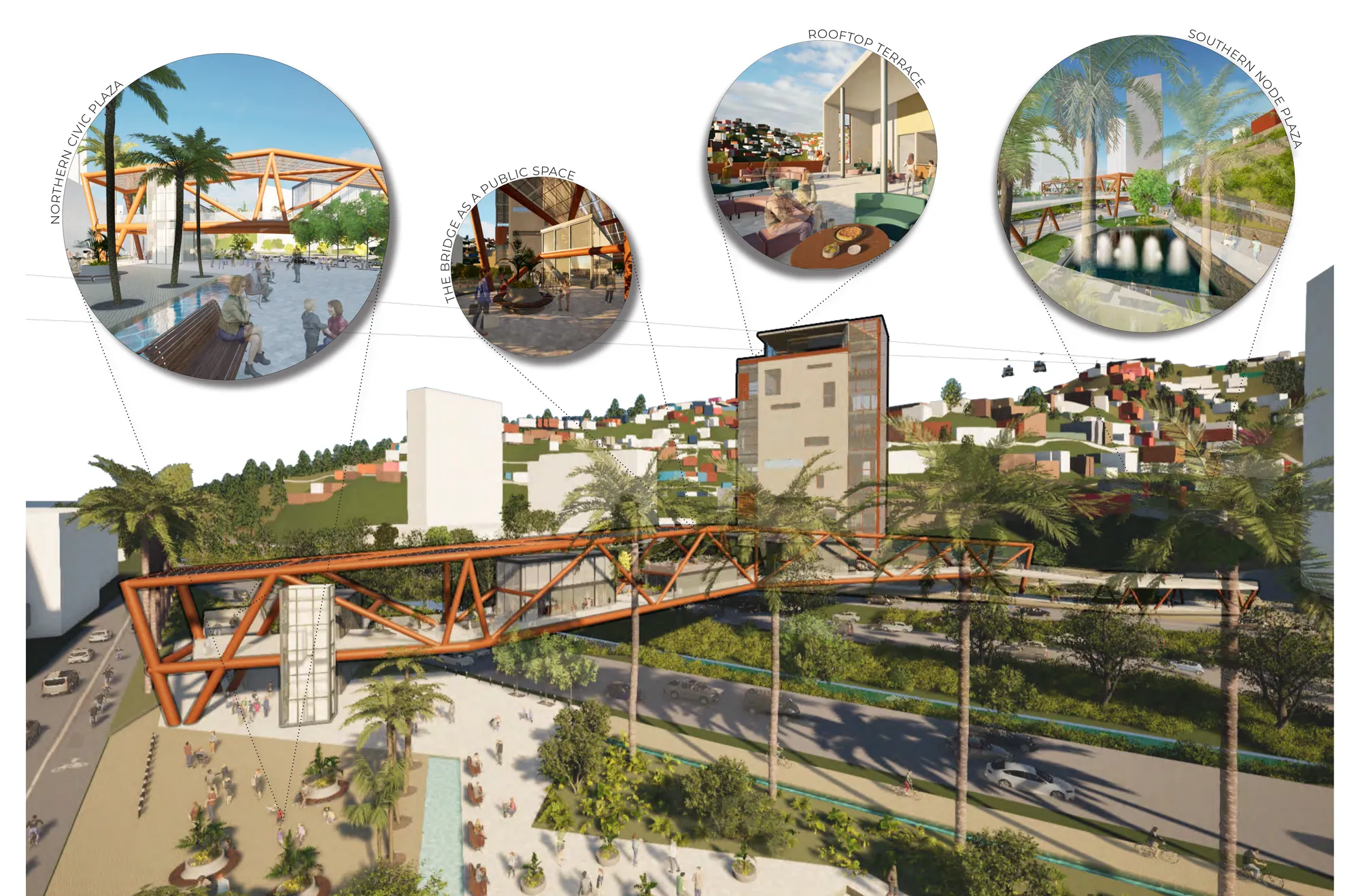
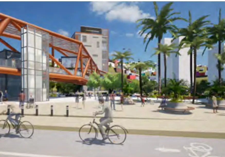
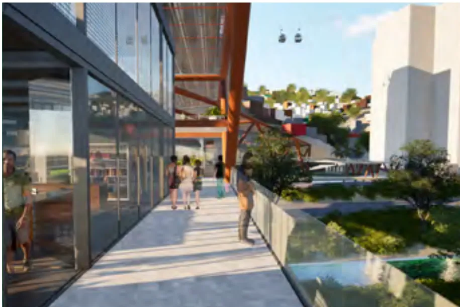
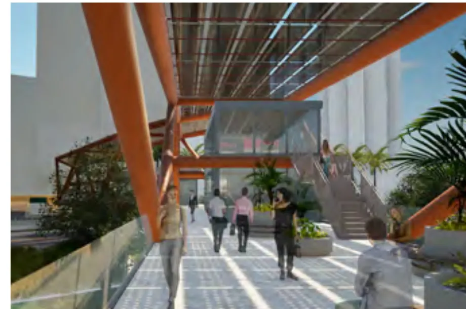
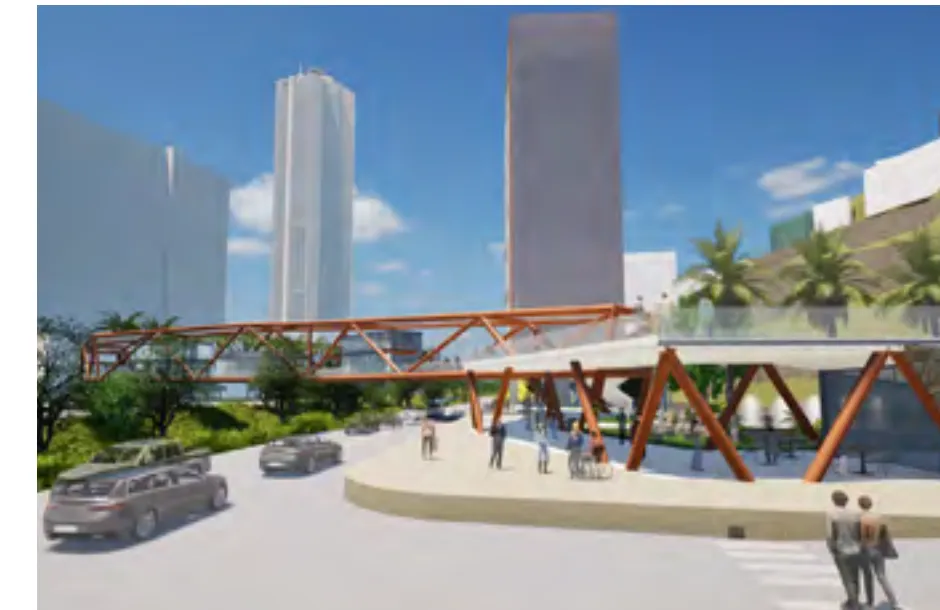
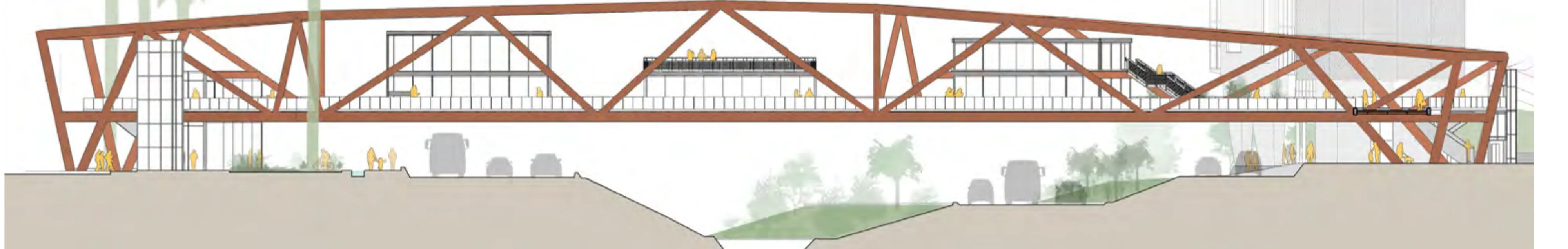
THE BRIDGE | CONNECTING NORTH TO SOUTH

Understanding the crossing as an integral part of the daily routine of most residents of La Charneca, the proposal reimagines the bridge as more than a pedestrian connection, defining it as an active commercial space for both local shops and artisanal showcases; acting as the new pedestrian entryway for the community and a spatial interaction between the formal and the informal city.

Render of the northern access: cyclists and pedestrians on a palm-lined plaza in front of the terracotta lattice portal of the bridge.
NORTHERN ACCESS
Render of the crossing towards the tower: people walking along the bridge deck between glazed shopfronts and planted edges, with metrocable cars and the hillside beyond.
CROSSING TOWARDS TOWER
Render of the crossing towards the city center: pedestrians under the terracotta structure and solar panel roof, with stairs rising towards the glazed walkway.
CROSSING TOWARDS CITY CENTER
Render of the southern street level: the lattice bridge spanning overhead between high-rise towers, with cars and pedestrians below.
SOUTHERN STREET LEVEL
Sectioned perspective of the bridge: the terracotta steel structure carrying a solar panel roof over a two-level commercial deck with people among shops and exhibits, flanked by circular detail callouts of the steel decking, the solar panel roofing and the welded connections.
THE BRIDGE — SECTIONED PERSPECTIVE steel decking detail · solar panel roofing · welded connections
Longitudinal elevation of the bridge: the terracotta lattice arching over the sectioned terrain and river channel, its deck lined with shops and figures, meeting the tower at the far end of the crossing.
LONGITUDINAL ELEVATION the bridge as an active commercial space across the river's limit

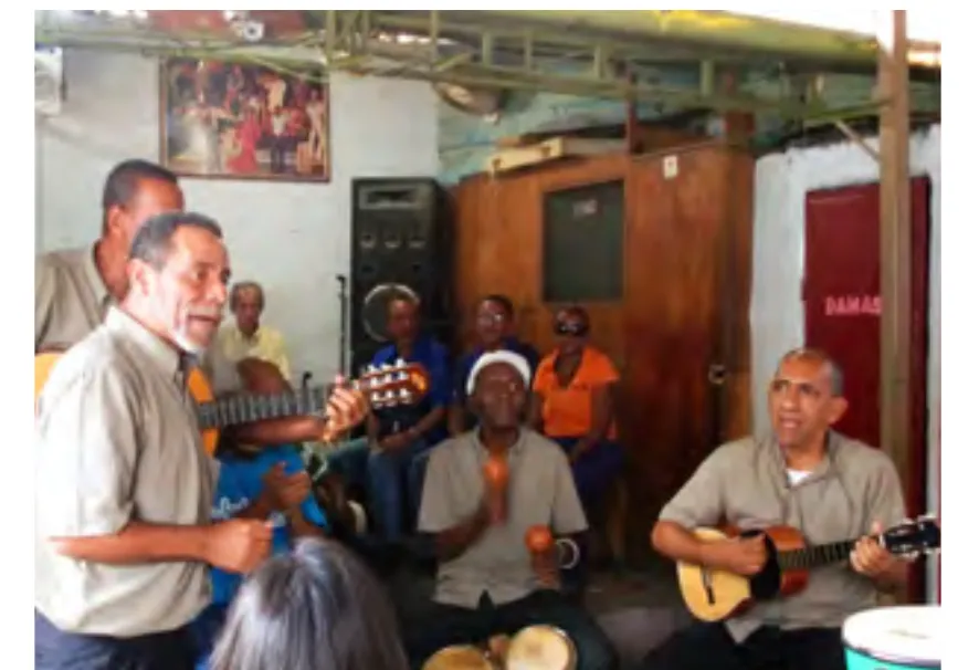
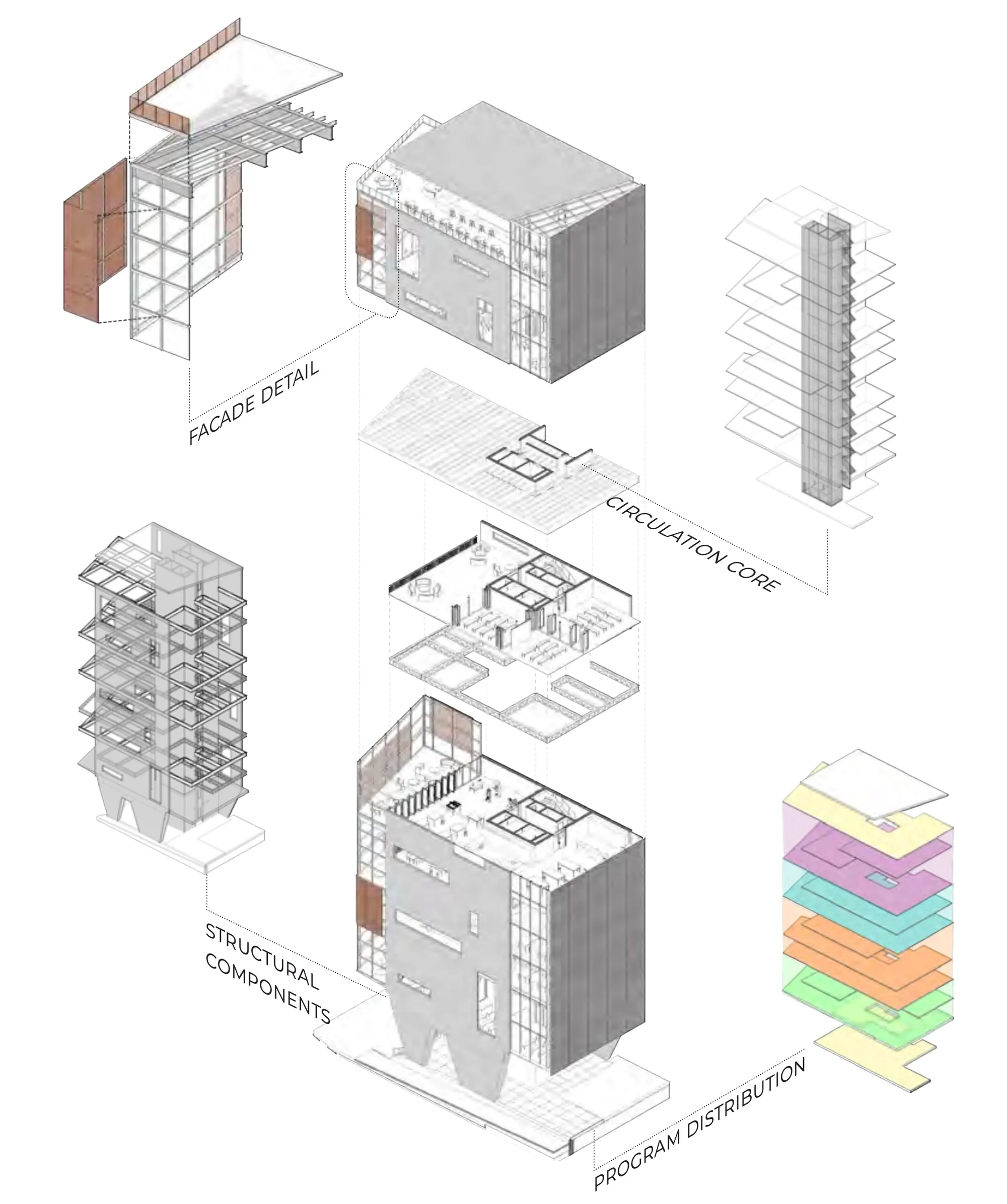
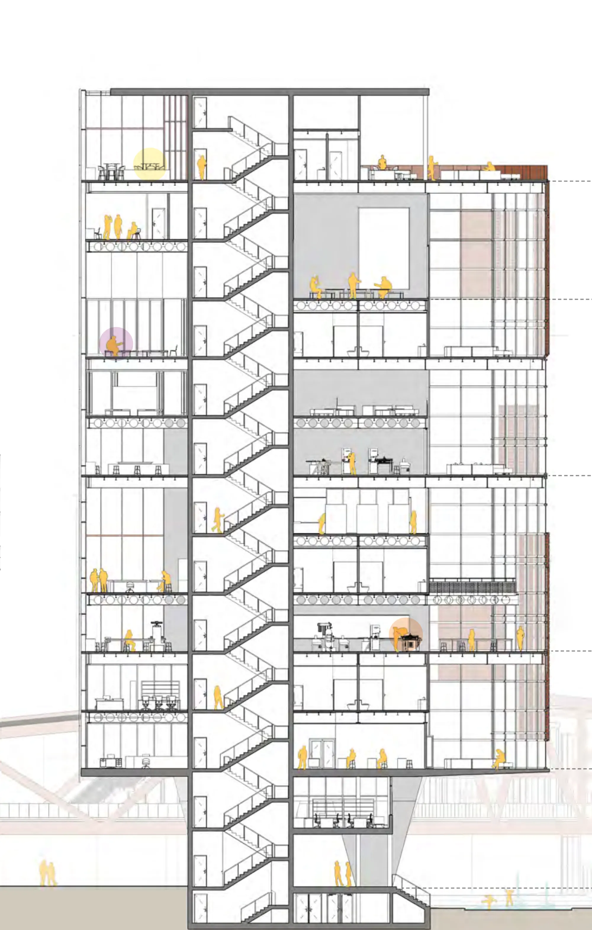
THE TOWER | MADERA GROUP’S CENTER

Considering the existing Madera Group’s musical center and its relevance for La Charneca’s community as part of its cultural and musical heritage, the tower is proposed as the new space for the foundation, integrating the musical component with educational spaces and skill learning workshops that focus on woodworking and craftsmanship, emphasizing the use of wood as both a renewable resource and a traditional material in Venezuelan music instruments.

Axonometric studies of the tower: the perforated facade detail with terracotta panels, the circulation core, the structural components of the frame, and the pastel-colored program distribution stack.
TOWER AXONOMETRICS facade detail · circulation core · structural components · program distribution
Tall sectioned perspective through the tower: twelve floors of classrooms, workshops and music rooms around the stair core, occupied by figures highlighted in yellow, with the terracotta bridge passing at its base.
THE TOWER — SECTIONED PERSPECTIVE classrooms · carpentry · luthier workshop · musical studies · rooftop terrace

URBAN TRANSVERSALITY | SEQUENCE OF PUBLIC SPACES

From the northern civic plaza to the bridge as a public space, the rooftop terrace and the southern node plaza, the project unfolds as an urban transversality — a sequence of public spaces linking the contrasting cityscapes of Caracas.